A lot of contractors in Palmerston North only realise they need proper monitoring when a crack appears in the neighbour's driveway. By then the council is involved, the programme slips, and the cost multiplies. The Manawatu's alluvial soils, especially the layered silts and sands near the river terraces, can move faster than people expect. Our technical team runs continuous deep excavation monitoring programmes that track lateral deflection, groundwater response, and settlement with survey-grade precision, so you get an early warning system rather than a surprise. We combine total station networks, vibrating wire piezometers, and in-place inclinometers to build a live picture of what the ground is actually doing behind the shoring. That data goes directly to the site engineer and the designer, keeping everyone ahead of the curve.
Good monitoring doesn't just measure movement — it tells you whether the ground behaviour matches the geotechnical model, and that's where the real risk management happens.
Technical details of the service in Palmerston North
Critical ground factors in Palmerston North
Last year we reviewed a site on the edge of the Terrace End commercial strip where a three-level basement was being cut into dense sand with a high water table. The initial monitoring plan only covered the shoring wall itself, and nobody was tracking the old brick warehouse next door. Within four days of pumping, a settlement trough had opened up under the warehouse footings, and the differential movement had cracked the façade. The lesson is that excavation monitoring in Palmerston North has to look outward as much as inward. We now insist on vibration and settlement arrays on all adjacent structures within a zone of influence defined by the Boscardin and Cording damage classification. If the project is within 15 metres of a sensitive building, we add real-time seismographs and optical targets that can detect sub-millimetre movement before it becomes visible to the eye.
Our services
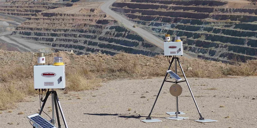
We go beyond placing a few survey prisms on a wall. Our approach to excavation monitoring in Palmerston North is built around the specific failure mechanisms that the local geology tends to produce — basal heave in soft clay, piping in silty layers, and lateral spread in liquefiable sands. The two core service packages below are designed to give the project designer and the contractor a single point of technical accountability from pre-excavation baseline surveys through to post-construction sign-off.
Design-Phase Monitoring Specification
Before the first bucket hits the ground, we prepare a site-specific instrumentation and monitoring plan that defines instrument types, locations, reading frequencies, and green/amber/red trigger levels. This document integrates with the contractor's methodology statement and becomes part of the consented construction management plan. We handle the baseline condition survey of neighbouring properties, which is critical for defending against future damage claims.
Construction-Phase Monitoring and Reporting
Full installation, commissioning, and daily management of the monitoring array throughout bulk excavation and substructure construction. We supply the field technicians, the data loggers, and the daily graphical bulletins that compare measured movement against predicted envelopes. If a trigger is breached, the responsible engineer receives a phone call within the hour, not an email the next morning.
Frequently asked questions
How much does geotechnical excavation monitoring typically cost for a Palmerston North basement project?
For a typical inner-city Palmerston North excavation — say a single-level basement with shoring on three sides — monitoring programmes generally fall between NZ$1,240 and NZ$3,970 depending on duration, number of instruments, and reporting frequency. A small cut with just survey prisms and a couple of piezometers sits at the lower end; a deep basement with in-place inclinometers, automated data loggers, vibration monitors on neighbouring buildings, and daily reporting for three months will be at the upper end. We provide a fixed-scope proposal after reviewing the shoring design and the adjacent structures, so there are no surprises halfway through the dig.
What is the difference between survey monitoring and in-place inclinometers for a shoring wall?
Survey prisms on the wall face tell you the total displacement at a point in space, which is great for tracking overall wall movement relative to fixed benchmarks. But they only show what is happening at the surface. In-place inclinometers installed in a borehole behind the wall give you the full deflection profile with depth, so you can see whether movement is concentrated at a particular weak layer — for example, a soft silt band at 5 metres depth in the Manawatu alluvium. Combining both methods gives the designer the complete picture needed to confirm or adjust the temporary works design.
Do I really need vibration monitoring if I am not blasting?
Yes, if you are working within 15 to 20 metres of an occupied building, even if the excavation is purely mechanical. Vibratory plate compactors, piling hammers, and heavy truck movements all generate ground-borne vibration that can cause cosmetic damage to plaster, brickwork, or services. We have seen vibration complaints from neighbours in the Hokowhitu area where cracking was attributed to excavation traffic, and the contractor had no baseline data to defend the claim. Installing a seismograph with real-time alerts gives you a defensible record and lets you adjust operations before damage occurs.